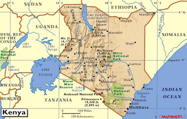
- Kenya is found in the Eastern part of Africa.
- Kenya has an area of 582 646 sq.Km.
- Kenya’s shape can be described as being broad to the North and narrow to the South.
- The equator almost divides Kenya into two equal parts.
- The countries neighbouring Kenya are Tanzania, Uganda, Somalia, Ethiopia and South Sudan.
- To the South-East, Kenya is bordered by the Indian Ocean.
- Kenya lies between latitudes 4 1/2ºN and 4 1/2ºS and longitudes 34ºE and 42ºE.
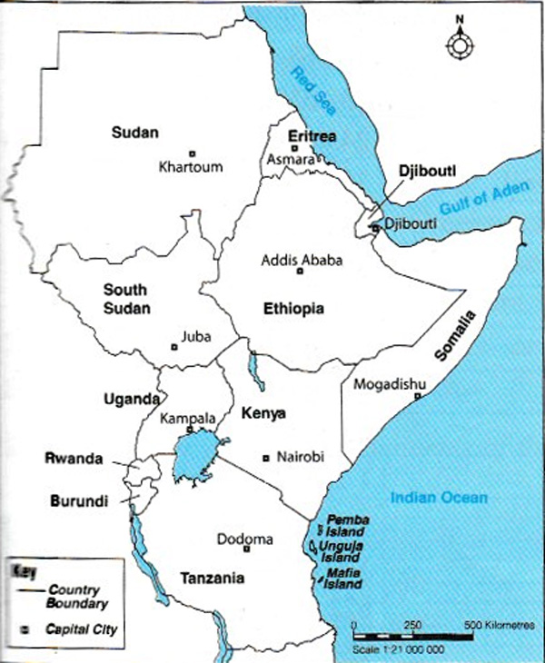
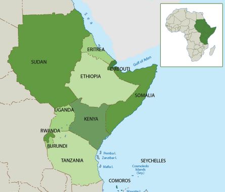
- Countries forming Eastern Africa are Sudan, South Sudan, Uganda, Tanzania, Kenya, Somali, Ethiopia, Eritrea, Rwanda, Burundi and Djibouti.
Sudan - 1 886 047 km2
South Sudan - 619 745 km2
Uganda - 241 038 km2
Tanzania - 945 100 km2
Kenya - 582 646 km2
Somalia - 637 700 km2
Ethiopia - 1 104 301 km2
Eritrea - 117 600 km2
Rwanda - 26 338 km2
Burundi - 27 834 km2
Djibouti - 23 200 km2
- Eastern Africa lies between latitudes 23ºN and 12ºS and longitudes 22ºE and 51ºE.
- It is found between the Tropic of Cancer and the Tropic of Capricorn.
- Eastern Africa covers an area of approximately 5 966 027 sq.km.
- The Equator passes through Uganda, Kenya and Somali. Eastern Africa is bordered by the Indian Ocean to the South-East and the Red Sea to the North-East.
- It is also bordered by Democratic Republic of Congo, Central African Republic, Chad and Libya to the West. Egypt borders it to the North, Malawi and Mozambique to the South.
- It is wider to the North and narrower to the South. Sudan is the largest country in Eastern Africa and Djibouti is the smallest.
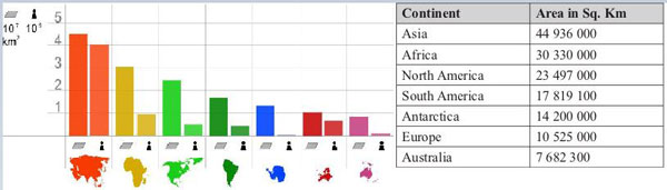
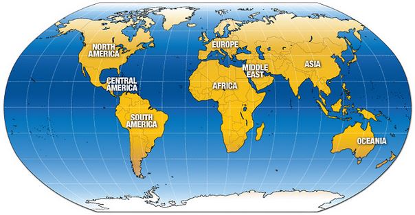
- Africa is the second largest continent in the world.
- The Mediterranean Sea is located to the North of Africa between Africa and Europe while the Red Sea is located to the North East of Africa separating Africa from Asia.
- Between the Red Sea and the Mediterranean Sea is the Suez Canal.
- The Indian Ocean borders Africa to the East while the Atlantic Ocean borders it to the West.
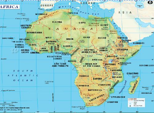
- Africa lies between latitudes 37ºN and 35ºS and longitudes 52ºE and 17ºW. The Equator, Tropic of Cancer and Tropic of Capricorn are important latitudes that pass through Africa.
- The 0º line of longitude called the Greenwich Meridian or Prime Meridian crosses Africa on the western side.
- The sizes of different continents are summarised in the table below.
These islands are found in the Indian Ocean.
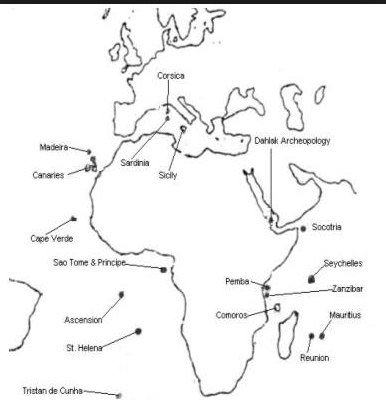
Islands found in the Atlantic Ocean include;
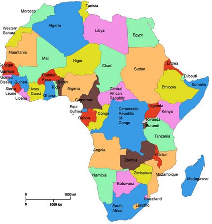
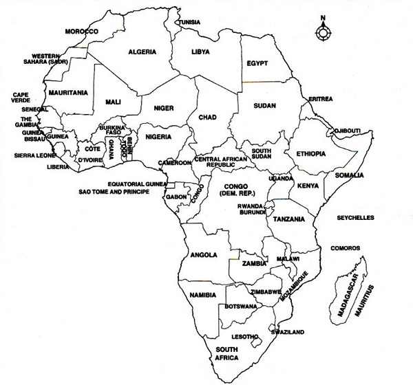
Africa has 55 independent countries. Algeria is the largest while Seychelles is the smallest.
Africa is connected to Europe by the Strait of Gibraltar. It is connected to Asia by the Suez Canal. It is separated from Arabia by the Sinai Peninsula and the Strait of Bab-el Mandeb.